Using Personal Drones in Crisis Management: Surveillance, Reconnaissance, and More
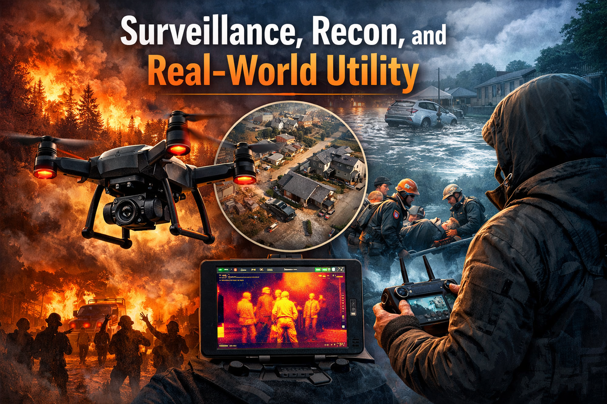
Surveillance, Recon, and Real-World Utility
Most people still think drones are weekend toys. Camera rigs. Something you fly over a lake once, then shove in a closet.
That framing is about 5 years behind.
In a real crisis, information is leverage. Leverage buys time. Time keeps people alive.
Wildfire pushing toward your neighborhood. Flooding that cuts off roads. Civil unrest two blocks over. The first thing that goes isn't power or cell service. It's clarity.
You can't see past your line of sight. Rumors travel faster than facts. Official response lags by hours. Personal drones close that gap fast.
Eyes before everything else
The biggest constraint in any emergency isn't strength or supplies. It's visibility.
A drone is airborne in under a minute and shows you what's actually happening. High-res cameras can spot stranded people, structural damage, rising water, gas leaks, open evacuation routes. You're making decisions off real footage, not social media noise.
Thermal imaging extends that further. Heat signatures cut through darkness, smoke, and low visibility conditions where you'd otherwise be guessing.
In search scenarios, that shortens the gap between "someone is missing" and "we found them." That's not a minor feature.
And unlike a helicopter, a drone costs $300 to $2,000, fits in a backpack, and doesn't risk a pilot.
Scout before you move
When supply chains break, guessing gets expensive.
Before you drive into a hazard, you can fly it first. Check road conditions, identify paths around blocked infrastructure, locate water sources, assess building damage before anyone walks inside.
After major earthquakes, aid convoys have used drone mapping to find safe access routes into affected areas. The same logic applies at the neighborhood level.
Some payload drones can carry a few pounds. Medical supplies, a radio, water purification tablets. Across a flooded road that cuts off a family, that delivery matters more than it sounds.
Documentation is leverage too
After the event, the fight becomes bureaucratic.
Clear aerial footage of property damage accelerates insurance claims. It creates a timestamped record. It cuts through the delay that comes when adjusters are overloaded and ground surveys take weeks. After major hurricanes, drone imagery quantified destruction faster than anything else on the ground.
In some configurations, drones can also carry small networking devices and act as temporary comms relays for isolated areas. That's a niche use case, but it's real.
What a coordinated neighborhood can do
When official systems get overwhelmed, communities either fragment or organize.
A few drones distributed across a neighborhood can monitor flood progression, flag hazards, verify evacuation routes, and share confirmed information instead of rumors. That's a meaningful capability upgrade for any group that bothers to build it beforehand (not during).
The actual limitations
Battery life is 20 to 45 minutes. You need spares, and you need to rotate them.
Wind and rain degrade performance. No-fly zones still apply during emergencies, which is worth knowing before you need to fly.
And skill matters, a lot. An untrained operator with a $1,500 drone is mostly just expensive.
Practical Drone Options for Crisis Preparedness
If you are thinking about adding a drone to your preparedness stack, here are three realistic options across different tiers.
DJI Mavic 3 Thermal
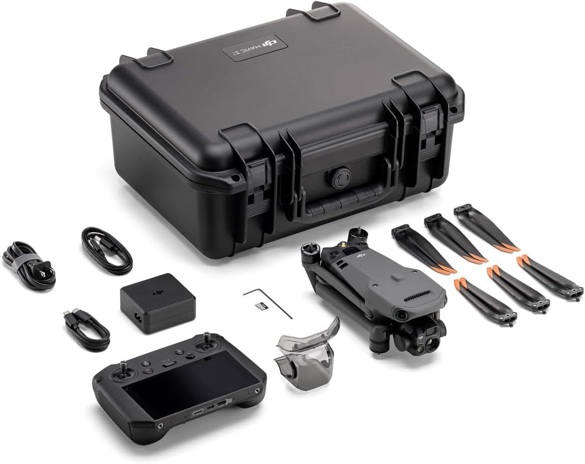
Strongest use case: search and rescue, wildfire monitoring, night operations.
- Thermal imaging capability
- Around 45-minute flight time
- 4K video
- Long transmission range
- Advanced obstacle avoidance
If thermal visibility matters to you, this is a serious tool. It is not cheap, but it is purpose-built for low-visibility scenarios.
Autel Robotics EVO Lite+
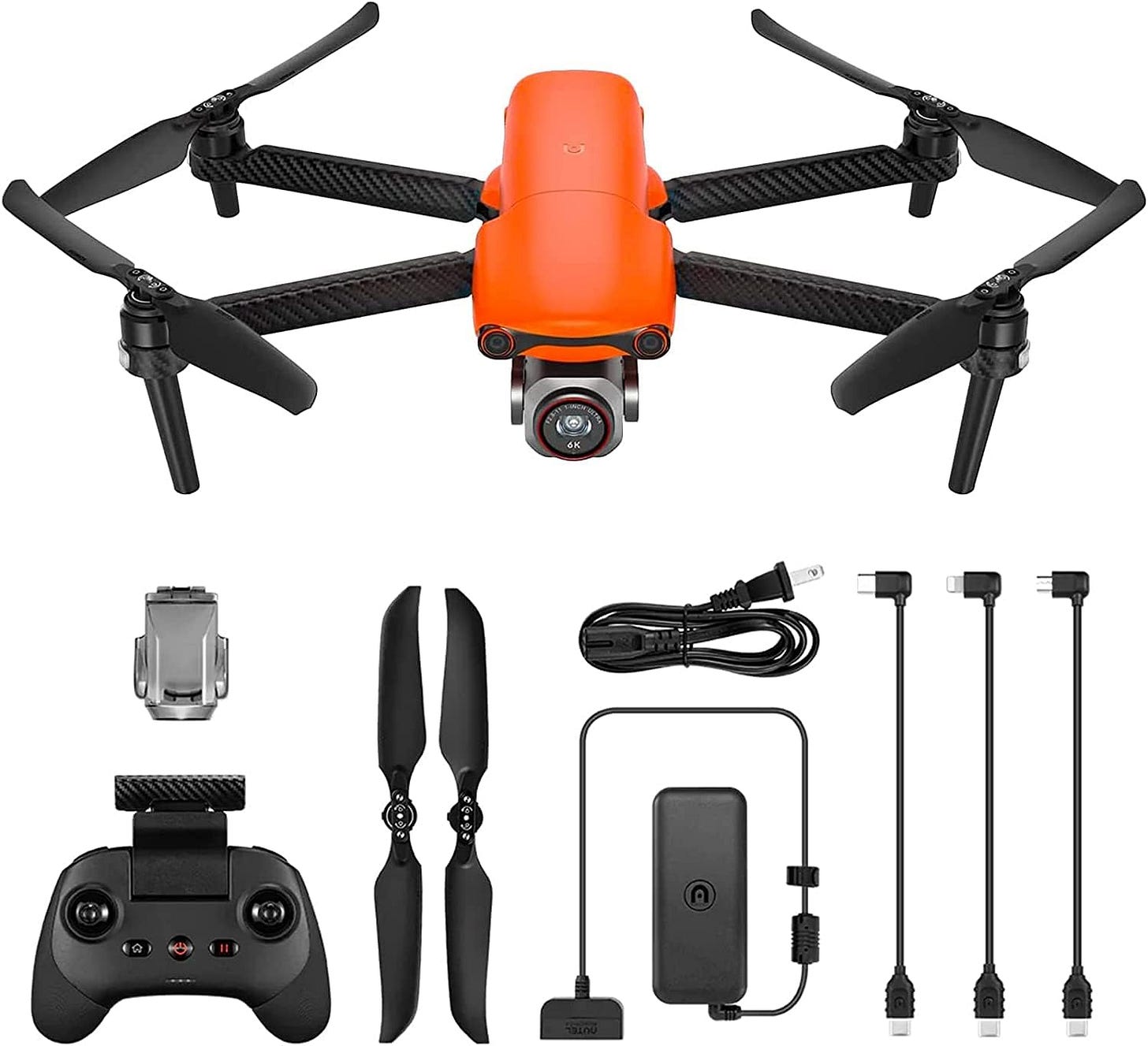
Strongest use case: high-quality mapping, documentation, general surveillance.
- Up to 40-minute flight time
- 6K camera
- Strong low-light performance
- Obstacle avoidance
- Compact form factor
This is a solid middle-ground option for someone who wants professional-grade visuals without jumping to thermal-level pricing.
Ruko F11PRO 2
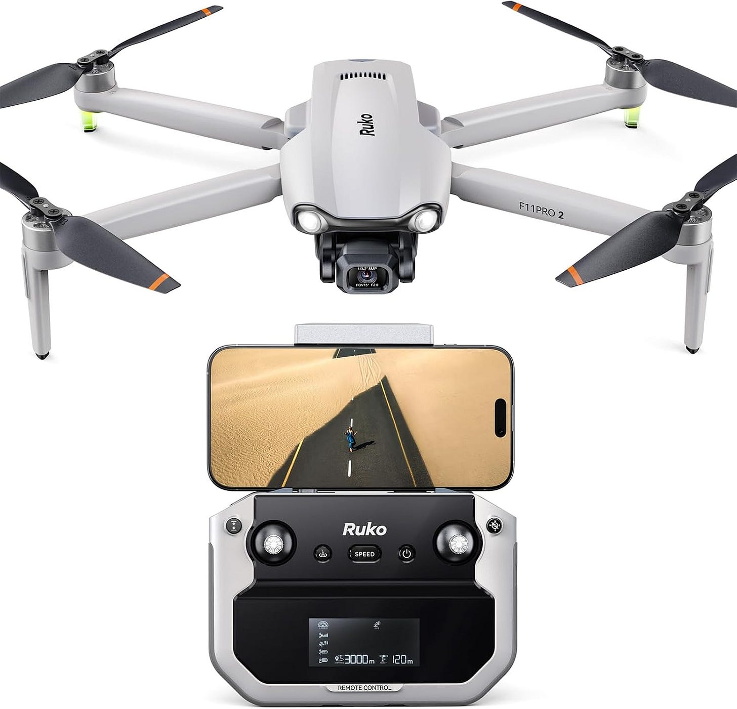
Strongest use case: budget reconnaissance and general monitoring.
- 6K camera
- Extended flight time with dual batteries
- 3-axis gimbal for stability
- Suitable range for neighborhood-scale operations
If you want capability without a large investment, this gets you airborne and functional.
Getting Started the Right Way
If you decide to integrate a drone into your emergency planning:
- Train before you need it. Fly in open areas. Understand wind limits and battery behavior.
- Keep spare batteries charged and rotated.
- Store it with your emergency kit, not buried in a closet.
- Understand local drone laws in advance.
- Think through use cases specific to your geography. Floodplain? Wildfire risk? Urban density?
Preparedness is contextual.
The Bigger Picture
Personal drones are not toys anymore.
They are mobile sensors. They are reconnaissance platforms. They are documentation tools. They are small-scale logistics assets.
In an era of increasing natural disasters, infrastructure strain, and social volatility, the ability to see beyond your immediate line of sight is not a luxury.
It is leverage.
We spend money on generators, water storage, medical kits, and go-bags. A drone fits into that same category if used intentionally.
The question is not whether governments and corporations will use aerial intelligence.
They already do.
The question is whether individuals and communities will build their own capacity.
Because when clarity disappears, whoever sees first decides faster.
And in a crisis, faster matters.
Comments ()